Self-Guided Itinerary Details
Day 1 Grand Canyon's South Rim:
The best locations to begin this trip from are Flagstaff, Williams, Tusayan or Grand Canyon Village (South Rim). Once you're on the road and ready to explore, you can begin this itinerary from either the South Entrance station and head toward Desert View or you can start at the East Entrance station and head toward Grand Canyon Village.
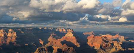
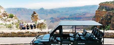
- We’ll assume that you’re entering from the South Entrance where you will then follow signs and park at the Grand Canyon Visitor Center. A short walk will take you to the first breathtaking view of the canyon at Mather Point.
- From there, you can either choose to walk along the easy, paved Rim Trail (.7 miles) or take the park’s free Orange/Kaibab shuttle bus to the Yavapai Geology Museum. Yavapai Geology Museum includes in-depth exhibits about how Grand Canyon formed, but most people just marvel at the view through the incredible windows that look right down at the bottom of the canyon. Looks closely and you’ll be able to spot two small glimpses of the Colorado River below you.
- From the museum, hop onto the park’s free Orange/Kaibab shuttle bus and explore the other canyon overlooks including Pipe Creek Vista, South Kaibab Trailhead and Yaki Point.
- Hop back in your car and head east along Hwy 64/Desert View Drive. Keep a close eye on the mile makers and a little past mile marker 246 you’ll see a small dirt parking lot on the left side of the road with a locked metal gate that leads down an old dirt road. This is the unmarked trailhead to Shoshone Point, one of the best views of Grand Canyon and well worth the flat and east 2-mile hike that it requires. This is great place to escape the crowds and have a relaxing few minutes to yourself.
- Once you’re done hiking, continue to drive east. Honestly, you’ll want to stop at all of the signed overlooks including Grandview Point, Moran Point, Lipan Point and Navajo Point. If you have enough time, you will also want to check out the Tusayan Ruins and Museum, where you’ll see the ancient stone ruins of the ancestral Puebloan people who inhabited Grand Canyon hundreds of years ago.
- The last stop is at the world-famous Desert View Watchtower, perhaps architect Mary Jane Colter’s best masterpiece sitting at the edge if Grand Canyon. Soaring 70 feet above the canyon rim, you can ascend the watch tower stairs and enjoy incredible paintings by famous Hopi artist Fred Kabotie throughout the different levels. Standing at the top of the watch tower, you’ll look down at a large expanse of the Colorado River below you as well as a vast view of the Painted Desert and the Navajo Indian Reservation to the east. If you can time seeing sunset at Desert View, you’ll certainly be glad that you did! Return to your area lodging for the evening.
Day 2 South to East Rim Drive:
Day two of your road trip will take you to Grand Canyon’s East Rim with a scenic drive through the Painted Desert and the Kaibab Plateau. As you leave Grand Canyon National Park from the East/Desert View entrance station, you’ll enter the land of the Navajo Nation. You’ll see signs for the Little Colorado River overlook which costs money to visit but offers you a great view of one of the most famous side canyons of the greater Grand Canyon. Continue east on Hwy 64 until you reach Cameron, AZ on Hwy 89N.
- Cameron has a famous trading post that offers a large gift shop and a restaurant. This is a great place to find work from native artisans but since they sell a lot of items that aren’t locally made, be sure to ask specifically if you’re looking for local native jewelry or artwork. The restaurant boasts the much beloved Navajo Taco, a fluffy piece of fry bread covered in taco toppings. You’ll leave full and happy.
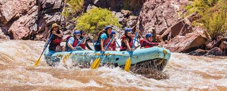
- Continue north to the Hwy 89A junction and marvel at the views of the colorful rock formations of the Painted Desert along the way. Turn left onto Hwy 89A. Your next stop will be the Navajo Bridge and the East Rim. The Navajo Bridge has a visitor center parking lot right off the highway and that is where you park to walk across the old version of the bridge on foot. Watch rafts float below you and keep an eye out for California condors that like to roost below on the metal structure of the bridge. Then head into Lee’s Ferry, a part of the Glen Canyon National Recreation Area. Here you will be able to touch the Colorado River that you only saw thousands of feet below you until now. Enjoy watching river rafters prepare for their two-week long whitewater adventures down the Colorado River.
- From here continue to your lodging destination for the evening which could include Page, AZ, Jacob Lake, AZ, Marble Canyon, AZ or Kanab, UT.
Day 3 Grand Canyon's North Rim:
To get to Grand Canyon National Park’s North Rim, you’ll turn at Jacob Lake onto Highway 67S. A quick stop at the Jacob Lake Inn is well worth it to enjoy one of their famous cookies or milkshakes. You’ll enjoy a scenic 45-mile drive through the forests and meadows of the Kaibab Plateau before you arrive at the national park entrance station.
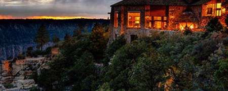
- Once you enter the park, follow signs for the visitor center or North Rim Lodge. Take the short and easy 1-mile roundtrip hike to Bright Angel Point for a grand and sweeping view of Grand Canyon. The North Rim Lodge is a great place to enjoy lunch or a cold drink (on the outdoor porch if you can!) before heading out to Cape Royal Road for the rest of the day. Cape Royal Road is unpaved but passable for passenger vehicles, no four-wheel drive required.
- There are numerous scenic overlooks along the way, and you should stop at all of them—Point Imperial, Vista Ecantada, Roosevelt Point and Cape Royal. There are a couple of options for scenic, flat day hikes along Cape Royal Road including Ken Patrick Trail from Point Imperial (up to 6 miles roundtrip) and Cape Final Trail (4.2 miles roundtrip). Timing a sunset at Cape Royal will reward you with an epic view and some once in a lifetime Grand Canyon photos for the last day of this awesome road-trip itinerary.
